AI & Satellites: Securing Lives in Disasters
Discover how AI and satellite technology enhance disaster response, enabling faster alerts, better planning, and life-saving decisions worldwide.
CLIMATE RESILIENCE
4/19/202516 min read
Natural disasters devastated U.S. crops in 2022, causing $21 billion in losses. This massive damage shows why we need technology to protect ourselves from catastrophes through advanced warning and response systems. The growing frequency and intensity of these disasters, driven by climate change, makes reliable technological solutions more vital than ever.
Disaster management technology has grown from simple manual methods to advanced systems that use artificial intelligence and satellite data. Hurricanes have been particularly devastating. They've caused more than $1.3 trillion in damage and claimed nearly 7,000 lives in the United States since 1980. Modern satellite networks now cover 99% of Earth's surface, which lets us coordinate rescue efforts even when regular communication systems break down.
This piece explores how AI and satellite systems are reshaping disaster response. We'll look at their structure, ability to detect damage as it happens, and ways to predict future events. The discussion includes real-life examples that show these technologies at work and explains their strengths and limitations in protecting lives during catastrophes.
AI and Satellite Architecture in Disaster Response Systems
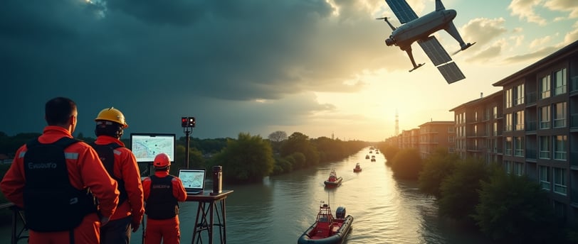
Modern disaster response systems work like a complex tech ecosystem with many connected layers. These systems protect humans from disasters by detecting, analysing and coordinating emergency responses.
AI and Satellite Architecture in Disaster Response Systems
Remote observation tech has become a key tool in managing disasters. It lets teams collect accurate information right away. Different tech elements work together to coordinate rescues and help authorities understand what natural disasters mean.
Data acquisition layers: satellites, drones, and IoT sensors
Disaster response systems collect data through three main layers. Each layer brings its own special features and views.
Satellites: The Global Perspective
Satellites orbit Earth and give a wide, non-stop view of affected areas. They watch large events like hurricanes, earthquakes, floods, and forest fires. Their advanced sensors capture images of huge areas and analyse them fast, even in hard-to-reach places. The European Union's Copernicus programme showed how satellites can give open data that helps respond to natural disasters.
Synthetic Aperture Radar (SAR) stands out as a game-changing satellite tech. It creates sharp images through clouds, smoke, and plants. This tech proved vital during the 2023 earthquakes in Turkey and Syria. SAR images mapped exact tectonic movements and helped figure out extra risks.
Drones: Precision and Agility
Satellites watch from above while drones get close-up views on the ground. They fly low and see specific spots with perfect accuracy. These flying machines carry special sensors, high-quality cameras, and heat vision tools. They check buildings and watch affected areas as things happen.
Drones use Ground-Penetrating Radar (GPR) in emergencies. This tech finds people stuck under fallen buildings and spots hollow spaces after collapses. After the Turkey and Syria earthquakes, drones helped find damaged city areas, spots needing rescue, and ways to deliver supplies.
IoT Sensors: The Foundation Layer
Small, low-power sensors and devices watch for disasters before they happen. They work for long periods in tough places without much upkeep. These sensors spot changes in things like heat, shaking, and air pressure. They warn us early about possible natural disasters.
IoT sensors, wireless tech, and AI analysis working together push disaster prevention forward. These devices gather info from around them and send it straight to main systems. They create a complete picture of what's happening in the environment.
Integration of Acquisition Layers
Modern disaster response really shines when all these data layers work together. The Palisades Fire in Los Angeles showed this well. Satellites spotted smoke automatically, which let emergency teams track the fire's movement. The Sentinel satellite system helped during the 2023 Libya floods too. It found flooded areas, spotted cut-off communities, and checked damaged buildings, even in bad weather.
AI makes these observation tools even better at handling data. Smart programmes can find affected areas on their own and tell cities from forests and water. During the 2019 Australian fires, AI quickly found damaged spots, which helped teams send help where needed most.
Edge vs cloud processing in emergency scenarios
Disaster response systems must choose between processing data near where it's collected (edge) or in central cloud systems. This choice affects how well emergency teams can help.
Edge Computing: Speed and Resilience
Edge computing handles data right where it comes from. This brings several big advantages in emergencies:
Faster responses: Processing data nearby means less waiting time. Teams can make decisions right away, which matters a lot in emergencies.
Keeps working when networks fail: Edge systems work even with bad internet. This helps when disasters break communication lines.
Better privacy: Local data processing means less information travels around. This protects sensitive details during emergencies.
Cloud Computing: Comprehensive Analysis
Cloud systems process data in central locations far from where it starts. Though slower, cloud computing brings key benefits:
Puts all data together: Cloud systems combine info from everywhere for complete analysis and storage.
More computing power: Clouds can run complex calculations, predict outcomes, and check damage thoroughly.
Teams work better together: Central cloud systems let different rescue groups see the same information.
Hybrid Approaches: The Optimal Solution
Most good disaster response systems use both edge and cloud computing. Data starts at the edge for quick processing, then goes to the cloud for deeper analysis.
NASA shows how this works with their new AI satellites that process images onboard. The CogniSAT-6 satellite, built by Ubotica and NASA JPL, processes its own data and sends results to Earth in minutes.
The mix of AI and satellite systems in disaster response needs careful balance. Quick local processing must work with deep central analysis. These systems help us predict disasters, respond fast, and reduce how much they hurt people.
Real-Time Damage Detection Using Satellite Imagery
Satellite-based disaster response systems need quick assessment capabilities as their life-blood. Quick detection and accurate mapping of affected areas help rescue teams prioritise their efforts based on severity and availability. This ended up saving more lives when every minute counts.
Real-Time Damage Detection Using Satellite Imagery
Synthetic Aperture Radar (SAR) for all-weather imaging
Optical satellite imagery provides valuable data but has major limitations during bad weather - exactly when disaster monitoring matters most. Synthetic Aperture Radar (SAR) technology solves this simple challenge by working well whatever the environmental conditions.
SAR works differently from optical sensors that need sunlight reflections. It actively collects data by sending out energy pulses and measuring their reflections after hitting Earth's surface. This key difference lets SAR work day or night and see through clouds, smoke, and vegetation. These abilities become invaluable during disasters.
SAR's effectiveness comes from its wavelength characteristics. The wavelength affects how radar signals interact with surfaces and determines how deep they can penetrate. L-band and P-band wavelengths penetrate deeper through vegetation and scatter more effectively. This makes them excellent at detecting structural changes under forest canopies.
SAR helps in many types of disasters:
Landslide monitoring: Measures tiny land movements down to centimetres using interferometric SAR (InSAR)
Oil spill detection: Spots oil-affected areas by finding changes in surface roughness
Flood mapping: Sees through vegetation to find flooding from rain
Earthquake damage assessment: Spots small land shifts after earthquakes
Real-life examples show SAR's amazing abilities. NASA's applied remote sensing training programme shows how InSAR maps the Portuguese Bend Landslide movement in California using Sentinel-1 data. Disaster teams can also find marine oil slicks using different types of polarimetric SAR data to help cleanup work.
Change detection algorithms for pre/post-disaster analysis
Change detection algorithms serve as the backbone of satellite-based damage assessment. They help identify affected areas with precision by comparing images from before and after disasters. Methods range from simple image comparison to advanced deep learning systems.
These algorithms work by finding differences between images taken at different times. This helps calculate changes in natural or human-made features. Research published in Frontiers in Environmental Science showed a new deep learning solution that achieved 90% accuracy in finding water-related disaster impacts.
Several approaches work particularly well:
Deep learning-based methods: Simple damage detection models using detailed satellite image pairs find water-related disasters with 90% accuracy without needing extensive damage labels.
Binary classification approaches: Models that spot local destruction using binary damage labels matching satellite image sizes need less detailed ground data.
Transfer learning techniques: Networks first learn simple classification tasks before focusing on damage detection. This helps them use learned geographical features about property loss.
Feature extraction comparisons: Algorithms that pull out features from before and after disaster images use these differences to predict damage levels.
A notable improvement uses a two-step solution: first finding buildings, then classifying damage. This method tackles both challenges of spotting buildings and checking their condition - key information to prioritise humanitarian help.
The process works in three steps: getting images, pulling out features, and analysing changes. The Temporal Change Index (TCI) proves especially useful here. Even basic image data can show destroyed areas, untouched regions, and rebuilding zones.
Real-world results show impressive accuracy. One study used the Random Forest classifier and achieved 90.4% accuracy in finding building damage from aerial images after the 2011 Christchurch earthquake and Japan tsunami. Another simple model found damaged areas from water disasters between 2011 and 2019 with 90% accuracy.
These technologies save lives better than traditional methods. Machine learning assessments work faster and cost less than ground inspections. This means humanitarian aid reaches people sooner. These systems also help find the best places to concentrate resources through predicted damage patterns.
Gupta et al. (2019) created the xBD dataset - the world's largest collection of disaster damage data. It provides before-and-after disaster images with detailed damage labels. This resource has sparked many new damage detection models, though grid-level prediction needs less detailed labelling.
SLIC (Simple Linear Iterative Clustering) shows promise too. It breaks images into uniform superpixels and extracts many features when reference data isn't available. This helps when teams need immediate damage assessment but lack pre-disaster images.
All-weather imaging and smart change detection algorithms make satellite-based damage assessment essential for modern disaster response. They show how technology protects people from disasters by enabling faster, targeted help when lives hang in the balance.
AI-Powered Predictive Modelling for Disaster Forecasting
Predictive analytics serves as the life-blood of modern disaster management. It helps authorities anticipate catastrophic events instead of just responding to them. These systems identify probable future outcomes based on historical patterns by utilising vast datasets, statistical algorithms, and machine learning techniques—this revolutionises how technology protects people from calamities.
AI-Powered Predictive Modelling for Disaster Forecasting
Predictive modelling shows its worth by knowing how to separate factors that cause disaster vulnerability (like infrastructure quality or income disparity) from random occurrences. This difference lets experts make meaningful predictions about future events and assess damage risk in areas with vulnerable infrastructure or higher hazard intensities.
Machine learning models for flood and cyclone prediction
Machine learning plays a vital role in flood prediction and disaster forecasting. Quick and accurate runoff forecasting helps save lives, reduce property damage, improve reservoir power generation, and keep water supplies safe.
Several machine learning algorithms work well for flood prediction:
Convolutional Neural Networks (CNN): These powerful deep learning algorithms excel at processing spatial data, including satellite imagery and digital elevation models. CNN-based hybrid models combined with Random Forest (RF) and Support Vector Regression (SVR) showed better results in flood forecasting.
Random Forest (RF): RF models analyse rainfall intensity, river levels, and topography to classify flood-risk areas. Research showed that a CNN-RF hybrid model worked better than standalone models for flood forecasting in river basins.
Support Vector Regression (SVR): SVR models work well for both short-term and long-term flood forecasts. They provide valuable insights for regional flood frequency analysis in arid and semi-arid regions.
Artificial Neural Networks (ANN): Hydrologists often use ANNs. These networks create reliable data-driven models of complex rainfall-flood relationships by learning from historical data rather than physical catchment characteristics.
Machine learning has changed how we predict and track cyclones. NASA and Development Seed showed this by using satellite images and machine learning to track Hurricane Harvey every hour instead of every six hours—the traditional method. This improvement gives vulnerable communities more time to prepare.
Neural networks help predict both cyclone path and intensity. They analyse meteorological data, sea surface temperatures, upper atmospheric wind patterns, and CNN-processed satellite imagery. Communities can evacuate earlier and position resources more precisely before storms hit land.
These predictive systems do more than forecast immediate events. They help authorities develop better emergency response plans by simulating various disaster scenarios. This planning capability becomes more valuable as climate change makes extreme weather events less predictable.
Neural networks trained on historical disaster datasets
The quality and amount of historical disaster data determine how well predictive models work. Deep learning algorithms have become particularly good at processing complex, multidimensional datasets for disaster prediction.
Recurrent Neural Networks (RNNs) work well with time-series data, making them valuable for flood risk forecasting. These networks spot subtle patterns that might signal upcoming floods by combining meteorological and hydrological conditions with land use data.
CNNs predict hurricane paths with unprecedented accuracy by analysing historical storm data and current atmospheric conditions. Google and Harvard showed this potential by developing an AI system that studied data from 131,000 earthquakes and aftershocks. The system predicted aftershock locations more accurately than traditional methods when tested against 30,000 earthquake events.
Building good datasets remains vital for training neural networks. The Sen1Floods11 dataset contains four subsets of surface water imagery from flood events and has helped improve flood detection accuracy. The xBD dataset offers the world's largest collection of pre-and post-disaster images with pixel-level damage labels.
Systems like the IIDIPUS tool use Modern-Era Retrospective analysis for Research and Applications (MERRA-2) measurements to predict tropical cyclone impacts. This helps map likely displacement patterns—key information for planning emergency shelter capacity.
Predictive modelling now focuses first on identifying populations likely to be displaced rather than calculating total financial costs. This approach helps reduce common long-term problems like forced migration or gentrification by directing humanitarian resources more effectively.
Resource allocation will always involve some uncertainty—larger exposed populations mean bigger potential errors. However, combining informative data with suitable risk models reduces this uncertainty. AI-powered predictive modelling helps technology protect people from disasters by providing crucial preparation time to evacuate and deploy resources where they save most lives.
Materials and Methods: Building a Disaster Tech Stack
Building effective disaster management systems needs a careful look at both architecture and tools. My work across Pakistan and the Maldives has shown me how the right technical setup can bridge the gap between early warnings and life-saving actions.
Materials and Methods: Building a Disaster Tech Stack
A disaster technology system needs more than just picking individual tools—it needs a framework that allows data to flow smoothly between platforms and agencies. These tech stacks help people access information before, during, and after disasters, which ended up deciding how well technology protects people from catastrophes.
Data pipeline architecture for multi-source integration
Data pipeline architecture serves as the life-blood of any disaster management system. It controls how information moves from collection to use. This framework sets rules for taking in, processing, changing, and storing data at different stages. A well-designed architecture can unite information from many sources into one central repository that becomes the single source of truth.
The architecture starts with data ingestion. Raw information comes from satellites, drones, IoT sensors, APIs, and local databases. This first stage shapes everything that follows—it determines what information analysts can use for response.
The data processing stage comes next. It changes raw inputs into usable formats through cleansing, validation, and standardisation. This automated process cuts down error risks and keeps data reliable by finding and fixing issues that could lead to wrong analysis.
Data orchestration plays a key role too. It coordinates data movement and makes sure processes run quickly. Good orchestration lets different systems talk to each other—vital when many agencies need to cooperate during emergencies. Poor coordination wastes time on manual data transfers or compatibility problems.
The architecture must handle several key factors:
Batch vs. streaming processing: Batch processing might need hours for big datasets. Streaming gives up-to-the-minute analysis—vital for fast-changing situations.
ETL vs. ELT approaches: Traditional Extract-Transform-Load (ETL) processes data before storage. Extract-Load-Transform (ELT) stores raw data first, which allows more flexible analysis later.
Edge vs. cloud computing: Edge processing works faster when connections are poor. Cloud systems offer better integration options.
Mixed approaches often work best. To cite an instance, see how Fox Networks uses both streaming and micro-batch processing in its disaster pipeline. This ensures people can access data even during critical events.
A disaster tech stack needs reliable data sources, quality controls, scalability, security, and backup systems. My time in vulnerable communities has shown that a reliable setup with spread-out storage and regular backups becomes essential when main systems fail during catastrophes.
Open-source tools: TensorFlow, QGIS, and Google Earth Engine
Open-source tools have changed disaster management by offering budget-friendly solutions that encourage cooperation. Three platforms stand out in modern disaster tech stacks:
TensorFlow has changed how we analyse spatial data through deep learning. Developers can now process and model large-scale spatial data quickly. It helps with:
Land use classification and change detection to spot environmental shifts
Predictive modelling to forecast floods, droughts, and heatwaves
Object detection to find critical infrastructure in satellite images
The platform handles large national-scale geographical datasets well, making it perfect to study both regional and global patterns. TensorFlow can spot flood-prone areas from satellite images and environmental data, which helps teams respond faster.
QGIS offers powerful open-source geographic information system features that work well with machine learning frameworks. Python integration allows custom applications for specific disaster needs. Its visualisation tools help share risk information better—key for coordination between agencies and communities.
Google Earth Engine (GEE) might be the most game-changing platform. It gives access to massive amounts of remote sensing data and fast parallel processing through Google's infrastructure. Users can access decades of satellite images from Landsat, MODIS, Sentinel, and ALOS, plus climate-weather and geophysical datasets.
GEE's JavaScript and Python APIs help build applications fast for:
Flood detection and monitoring
Wildfire mapping and analysis
Surface water mapping for humanitarian response
This platform shines in places with limited resources. During Pakistan's 2022 floods, these tools helped us quickly assess crop damage and find isolated communities. This guided how we shared resources when infrastructure failed.
These tools let teams create custom solutions without spending big on private systems. The Sahana Eden framework shows this approach well. It offers modules for organisation directories, human resource management, risk assessment, and resource tracking—all vital for coordinated disaster response.
Teams can build effective disaster tech stacks by combining reliable pipeline architecture with these open-source tools. This boosts community resilience and changes how technology protects people from disasters.
Results and Discussion: Case Studies from South Asia
South Asia faces some of the world's worst climate challenges. This makes the region perfect to test how satellite and AI technologies work in extreme conditions. My fieldwork in this region shows these tools aren't just theoretical ideas - they save lives when we use them right.
Cyclone Amphan: Satellite-based damage mapping in Bangladesh
Cyclone Amphan hit Bangladesh and Eastern India on 20 May 2020. The storm killed at least 96 people and left massive infrastructure damage in its wake. The International Centre for Integrated Mountain Development (ICIMOD) stepped in with Sentinel-1 radar imagery to map flood-affected areas.
Radar satellite data proved incredibly useful because it works in any weather condition - even with heavy clouds or at night. This gave teams a huge advantage when tracking the cyclone's destruction. Relief agencies got precise maps of the hardest-hit areas, which helped them coordinate aid more effectively.
The data showed major flooding in three key districts: Satkhira, Khulna, and Bagerhat. Parts of Gopalganj and Barisal also suffered significant damage. The situation became even more complex because the flood hit during the COVID-19 pandemic. This made it really hard to maintain social distancing in evacuation centres - exactly the kind of complex disaster that needs advanced tech solutions.
Scientists noticed something interesting during their analysis. The Sundarbans mangrove forest barely showed up in the flood radar data. This wasn't because it escaped the cyclone's impact. The delta regions are always so water-logged that the before-and-after images looked almost identical.
Pakistan floods 2022: AI-driven crop loss estimation
The 2022 Pakistan floods rank among history's worst climate disasters. Satellite analysis revealed flooding covered 2.5 million hectares (18% of Sindh province). About 1.1 million hectares of this was farmland. The floods damaged 57% of Sindh's agricultural areas.
AI models calculated crop losses with amazing accuracy. Cotton production fell by 88% (3.1 million bales), rice by 80% (1.8 million tonnes), and sugarcane by 61% (10.5 million tonnes). These three crops alone lost USD 1.30 billion in value. Vegetable crops added another USD 374 million in damages.
Scientists used Synthetic Aperture Radar (SAR) to spot flooded areas. They then mapped vegetation loss using delta NDVI (Normalised Difference Vegetation Index). Their findings showed severe damage to 36% of cropland and moderate damage to 53%. Machine learning models then predicted specific crop yields based on these vegetation patterns.
Climate change keeps making weather extremes worse in this region. These examples show how technology helps protect people through accurate damage assessment. My work with vulnerable communities in South Asia has shown me how these tools help target resources where they're needed most. This matters deeply in a region that saw 54% of the world's disaster-related deaths in 2015.
System Limitations in AI and Satellite-Based Response
AI and satellite-based disaster response systems have made amazing progress, but they still face major limitations in real-life applications. My 13 years of experience in disaster risk reduction across Pakistan and the Maldives has shown me these practical challenges firsthand.
The quality and quantity of data creates the biggest problem. AI models can only work as well as their training data allows. Bad or missing information leads to unreliable results when it matters most. This becomes a serious issue in places like South Asia where historical disaster records are either missing or poorly maintained.
The technical side poses another major challenge. High-resolution satellite images need lots of computing power and time to process. The coverage from satellites isn't frequent enough - SAR satellites that orbit the poles only capture images every 12-14 days. Commercial satellite networks help reduce delays, but current systems don't deal very well with fast-moving disasters like flash floods.
Money remains a huge barrier. Building and running AI systems for disaster management requires big investments in equipment, programmes, and expert knowledge. Sadly, areas most at risk often can't afford these costs.
Privacy adds another layer of complexity. These systems use location data, social media posts, and personal details to check damage and find people during disasters. This raises important questions about using people's information without their permission.
The day-to-day challenges include:
Systems don't work well with current emergency response setups
Not enough people know how to use the technology
Teams rely too much on AI when time is critical
Systems can't adapt well to unexpected disasters
Many disaster response tools still need human input, which slows everything down and increases the chance of mistakes. Complex AI systems work like a black box, making it hard to spot problems or understand why decisions were made.
All the same, recognising these problems is the first step toward better solutions. By tackling these challenges head-on, we can keep improving how technology helps protect people from disasters - even in the toughest conditions.
About the Author
This article was written by Imran Jakhro, a Climate Resilience and Early Warning Anticipatory Action Expert with over 13 years of experience in the field. Imran has dedicated his career to developing innovative solutions for disaster risk reduction, focusing on using technology to enhance climate resilience and improve early warning systems.
For inquiries, contact: contact@imranahmed.tech
Visit: www.imranahmed.tech
Related Articles You May Find Useful:
Portfolio: Disaster Risk Reduction Strategies
Explore real-world disaster risk reduction programs that strengthen community resilience and reduce climate vulnerabilities across South Asia.
Geospatial Analysis for Accurate Risk Maps in 2025
Discover how cutting-edge geospatial technologies and satellite data are revolutionizing disaster preparedness and early warning systems.
Climate-Proof Livelihoods in the Global South
Learn how innovative livelihood models are helping vulnerable populations adapt to climate shocks and build sustainable futures.
Anticipatory Action vs. Traditional Aid: What Works Best?
Compare proactive disaster response with traditional humanitarian aid and see why anticipatory action is saving more lives.
Islamabad Hailstorm Unveils Pakistan’s Climate Crisis
A deep dive into a recent climate disaster and what it reveals about Pakistan’s growing climate vulnerability.
References
How AI Predictive Analysis Helps Detect Natural Disasters – Glair.ai
AI and Natural Disaster Prediction: Emerging Technologies – Saiwa.ai
Predictive Analytics in Disaster Prevention Using Machine Learning – IEEE Public Safety
Machine Learning for Disaster Risk Reduction and Early Warning – Frontiers in Environmental Science
Understanding Modern Data Pipeline Architecture for AI Models – Airbyte
Optimizing Data Pipelines for Real-Time Risk Assessment – Rivery.io
AI-Powered Disaster Forecasting Using Earth Observation Data – Nature Scientific Reports
Satellite-Based Crop Loss Assessment After the 2022 Pakistan Floods – ReliefWeb
Change Detection in Remote Sensing for Risk Mapping – ScienceDirect
Special Issue: Natural Hazard Mapping with Google Earth Engine – MDPI Remote Sensing Journal
Impact
Pioneering resilience through global development practices.
Contact
Reach
contact@imranahmed.tech
+92 333 3283340
© 2025. All rights reserved.
Legal
imranahmedjakhro1@gmail.com